Rendered at 08:18:22 06/25/25


 City Folding Tourist Map 1960")
 City Folding Tourist Map 1960")
 City Folding Tourist Map 1960")
 City Folding Tourist Map 1960")
 City Folding Tourist Map 1960")
 City Folding Tourist Map 1960")
 City Folding Tourist Map 1960")
 City Folding Tourist Map 1960")
 City Folding Tourist Map 1960")
 City Folding Tourist Map 1960")
 City Folding Tourist Map 1960")
 City Folding Tourist Map 1960")
 City Folding Tourist Map 1960")
 City Folding Tourist Map 1960")
Envío gratis
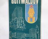
Rare Vntg Gottwaldov (now Zlín City, Czech Rep) City Folding Tourist Map 1960
Los buques de
Bosnia and Herzegovina


Las opciones de envío
GRATIS a Worldwide
Los buques de
Bosnia and Herzegovina
Política de oferta
OBO - El vendedor acepta ofertas en este artículo.
Detalles
La política de devoluciones
Protección de compra
Opciones de pago
PayPal accepted
PayPal Credit accepted
Venmo accepted
PayPal, MasterCard, Visa, Discover, and American Express accepted
Maestro accepted
Amazon Pay accepted
Nuvei accepted
Rasgos del artículo
| Categoría: | |
|---|---|
| cantidad disponible: |
Sólo uno en stock, para muy pronto |
| Condition: |
Unspecified by seller, may be new. |
| Type: |
City Map |
| Original/Reproduction: |
Vintage Original |
| Date Range: |
1960-1969 |
| Year: |
1960 |
| Country/Region: |
Czech Republic |
| Format: |
Folding Map |
| Era: |
1960s |
| State: |
Czech Republic |
| City: |
Gottwaldov |
Detalles del anuncio
| Envío de descuento: |
Vendedor paga el envío para este artículo. |
|---|---|
| Publicado en venta: |
Más de una semana |
| Artículo número: |
1585849252 |
Descripción del Artículo
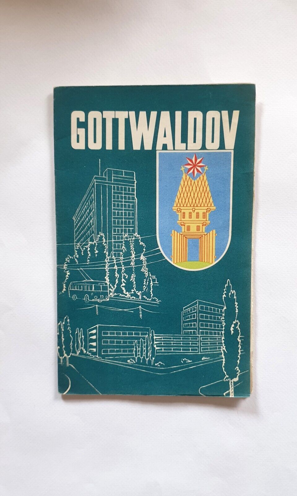
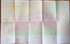
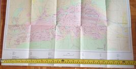
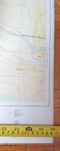
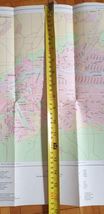
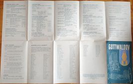
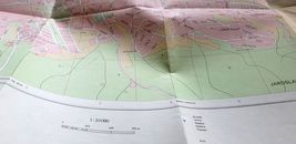
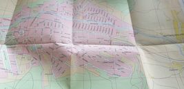
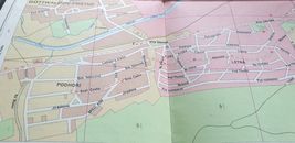
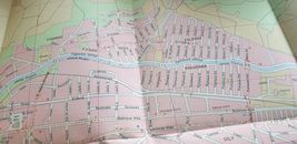
Rare vintage Gottwaldov city (now name Zlín City, Czech Republic, City Folding Touristic Map with guide, street names, etc - Orientacni Plan, from 1960 (from period of Ex-Czechoslovakia)
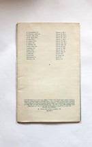
One side print, maps and legend on the front
Backside: streets names and street guides
Map size unfolded: 66x42 cm
Added to your wish list!
- Rare Vntg Gottwaldov (now Zlín City, Czech Rep) City Folding Tourist Map 1960
- 1 in stock
- Price negotiable
Get an item reminder
We'll email you a link to your item now and follow up with a single reminder (if you'd like one). That's it! No spam, no hassle.
Already have an account?
Log in and add this item to your wish list.