Rendered at 15:21:42 10/28/25


VTG 1940s Soil Conservation Map Kentucky State Reformatory Farm La Grange KY
Los buques de
United States

Share & earn! Sign in, share this or any listing, and you’ll get commission when it sells.
Learn more
Las opciones de envío
No hay precio de envío se especifica en ES
Los buques de
United States
Política de oferta
OBO - El vendedor acepta ofertas en este artículo.
Detalles
La política de devoluciones
Full refund available within 30 days
Protección de compra
Opciones de pago
PayPal accepted
PayPal Credit accepted
Venmo accepted
PayPal, MasterCard, Visa, Discover, and American Express accepted
Maestro accepted
Amazon Pay accepted
Nuvei accepted
Rasgos del artículo
| Categoría: | |
|---|---|
| cantidad disponible: |
Sólo uno en stock, para muy pronto |
| Condition: |
Unspecified by seller, may be new. |
| Original/Reproduction: |
Vintage Original |
| Date Range: |
1940-1949 |
| Country/Region: |
United States of America |
| US State: |
Kentucky |
| Format: |
Folding Map |
| Type: |
Soil Map |
| City: |
LaGrange |
Detalles del anuncio
| Envío de descuento: |
No ofrece el envío combinado |
|---|---|
| Publicado en venta: |
October 24 |
| Artículo número: |
1775060801 |
Descripción del Artículo
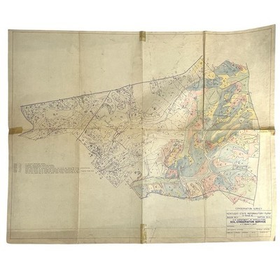
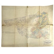
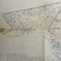
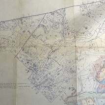
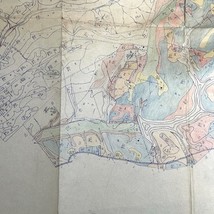
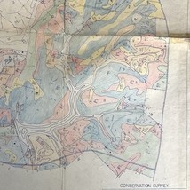
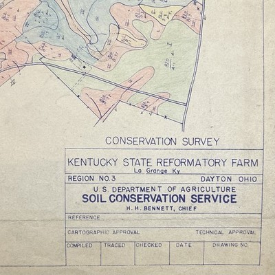
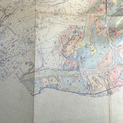
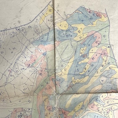
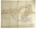
Original USDA Soil Conservation Service Map
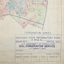
Title: Conservation Survey ? Kentucky State Reformatory Farm
Location: La Grange, Kentucky
Region: No. 3 ? Dayton, Ohio
Agency: U.S. Department of Agriculture, Soil Conservation Service
Chief: H.H. Bennett
Details:
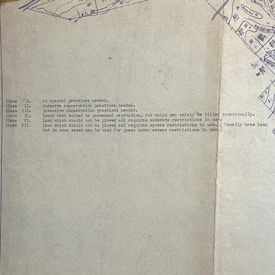
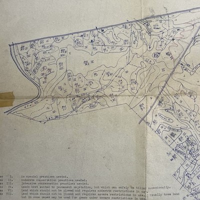
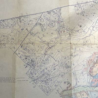
? Vintage soil classification and land-use map
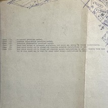
? Hand-colored regions indicating soil types and classes (I?VII)
? Includes key for conservation practice levels
? Large format, folded ? approx. 24" 30"
? Original vintage paper with visible fold lines and tape repairs
? Historically tied to the Kentucky State Reformatory Farm, a significant state agricultural facility
Condition:
Fair to good vintage condition. Folded, with edge wear, mild toning, and taped seams for reinforcement. Map remains legible and displays beautifully for framing or archival study.
Excellent reference for historians, soil scientists, or Kentucky collectors.
Added to your wish list!
- VTG 1940s Soil Conservation Map Kentucky State Reformatory Farm La Grange KY
- 1 in stock
- Price negotiable
- Returns/refunds accepted
Get an item reminder
We'll email you a link to your item now and follow up with a single reminder (if you'd like one). That's it! No spam, no hassle.
Already have an account?
Log in and add this item to your wish list.